
Google has compressed the power of its Street View cars into a cute, 15-pound camera

Fifteen years after Street View started as a wild idea at Google to create a 360-degree map of the world, the feature is more important than ever to the Google Maps product. The images collected by Street View cameras are a key part of Google’s mapping efforts and are laying the groundwork for Google’s more immersive features.
On Tuesday, Google unveiled a new, relatively compact camera that will help the company continue its efforts to maintain up-to-date imagery of basically everywhere on the planet.
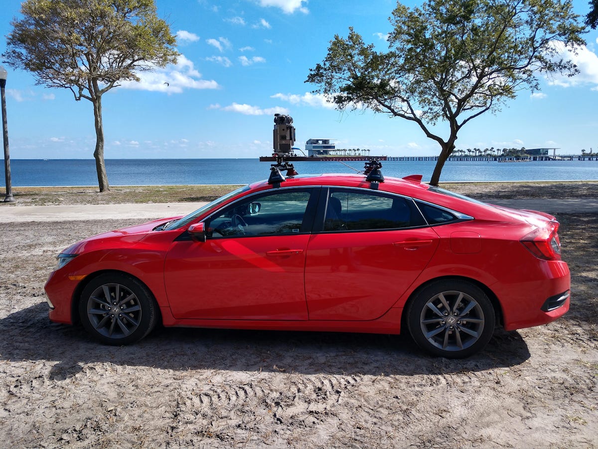
Typically, Google collects high-resolution Street View photographs with a camera bolted to the top of a car. Google’s Street View cars have enough processing electronics to fill the back seat.
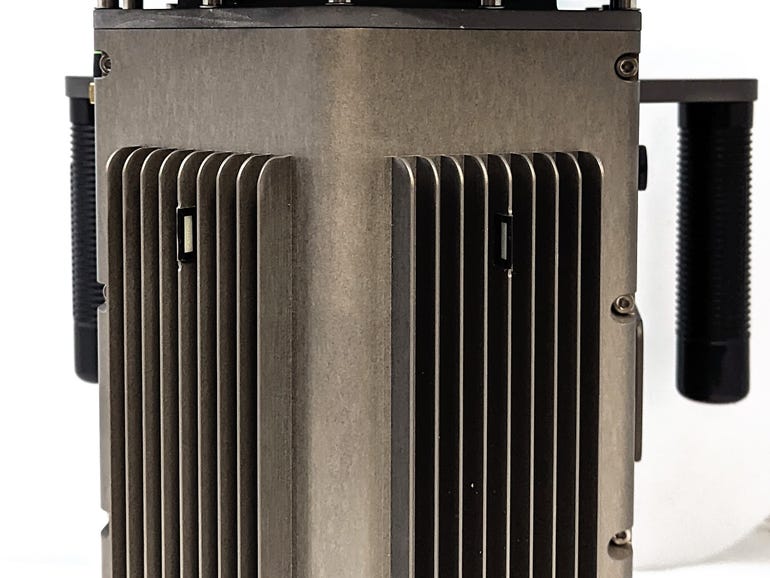
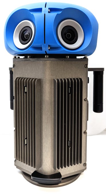
The new camera “takes all the power and resolution and processing capability of our entire Street View system… [and has] compressed that into something the size of a large, happy house cat,” Google’s Steve Silverman told reporters.
The device, which can be held with one hand, weighs less than 15 pounds. It has has seven cameras total, and it delivers 140 megapixels in every panorama. Google also has the capacity to add Lidar to the device, to capture details like lane markings or pot holes.
The new device builds on the Street View Trekker, a camera attached to a backpack that Google first introduced in 2012. That system helps Google collect images of indoor spaces and other places cars can’t go — even under the ocean and into space.
“The hardware we build has to work across some complex environments, like rugged conditions we might encounter,” Silverman said. “These places include environments like the cold of the Arctic, the heat at the edge of a volcano, and bouncing around cobblestones in Brazil.”
Google’s new camera is designed so that it can attach to any car with a roof rack and controlled with a mobile device. The company is piloting the camera now and will roll it out in 2023.
So far, Google has collected 220 billion Street View images from more than 100 countries and territories. Google collects images of the same locations repeatedly to ensure that they’re up to date. On the desktop version of Google Maps, users have been able to look at historical Street Views to see how streets have changed over the years. Starting Tuesday, Maps users on Android and iOS devices will also be able to look at historical Street Views. When viewing Street View imagery of a place, tap anywhere on the photo to see information about the location. Then tap “See more dates” to see the historical imagery Google has published of that place, dating back to when Street View launched in 2007.